
Town of Montgomery ZIP Code Directory Coverage
Six ZIP codes appear around the Town of Montgomery and its adjacent municipal geography on the Orange County ZIP map. The Town includes the villages of Montgomery, Walden, and Maybrook, while postal delivery areas cross those boundaries. The table identifies the documented relationship for each ZIP instead of claiming a parcel-level coverage line that was not verified. For any particular street address, the final postal-format check is USPS and the jurisdiction check is Orange County GIS.
| ZIP | Areas | Post Office | Notes |
|---|---|---|---|
| 12543 | Maybrook and surrounding Town area | USPS Maybrook | Maybrook postal city |
| 12549 | Montgomery village and Town addresses | USPS Montgomery | Montgomery postal city |
| 12550 | Middletown postal area touching broader Town geography | Postal-area verification required | Exact Town parcel subset was not verified |
| 12575 | Rock Tavern near southern and eastern Town geography | Postal-area verification required | Exact Town parcel subset was not verified |
| 12586 | Walden village and surrounding Town addresses | USPS Walden | Walden postal city |
| 12589 | Wallkill near the northern Town boundary | Postal-area verification required | Exact Town parcel subset was not verified |
A postal city label can be useful for mail and a search form, but it cannot decide whether a location lies in the Town, one of its villages, or another municipality. Keep postal city, ZIP, parcel ID, and municipal label as separate fields when comparing records.
Six ZIP Codes Across Town of Montgomery
The postal search needs a geography check because Montgomery’s record systems use different boundaries. Town status dates to 1788, while the Village of Montgomery incorporated in 1810, Walden in 1855, and Maybrook in 1926. Original Town boundaries also included parts of present-day Crawford and Hamptonburgh. Older deeds, directories, and maps can therefore use a place name that does not line up with a present postal label.
Census QuickFacts for the Town of Montgomery provides the current Census geography context used alongside postal sources.
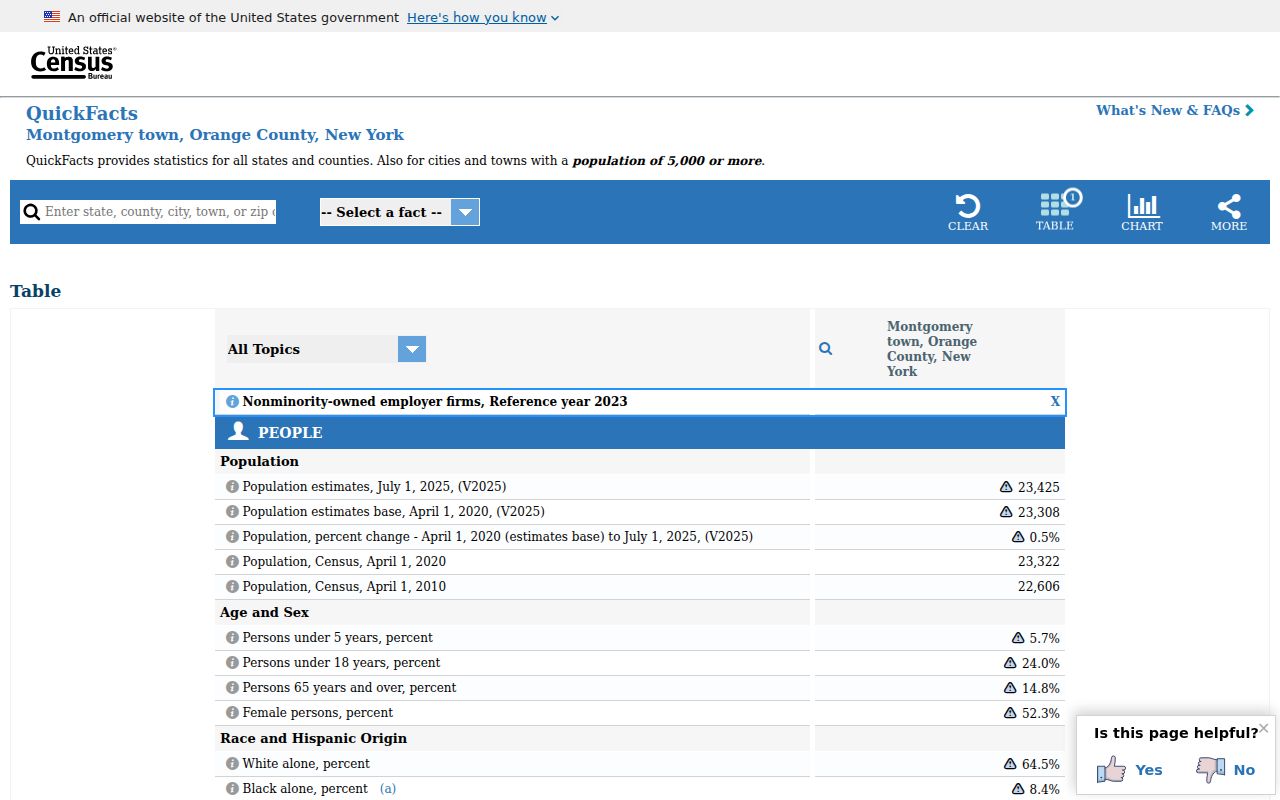
The Census source reports 50.26 square miles of land. The Town Highway page uses a separate 51.11-square-mile figure, so the two numbers should not be merged. Those source labels matter when a ZIP map is being compared to a Town map.
Town of Montgomery ZIP USPS Check
The official USPS tool offers three useful modes. By Address requires Street Address, City, and State, with optional company, unit, urbanization code, and ZIP fields. By City and State can return more than one ZIP. Cities by ZIP begins with the ZIP and returns recognized city names. Use the returned format for delivery, then move to GIS for municipal and parcel questions. USPS specifically cautions that an address result does not confirm a person or company at that address.
USPS ZIP Code Lookup is the official postal check for those address, city-state, and ZIP modes.
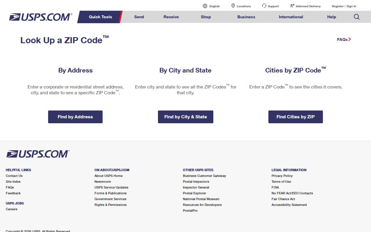
The USPS form helps standardize a street address before a Town of Montgomery ZIP code search. It does not show municipal authority, parcel ownership, or present occupancy, and it should not be used as proof of any of those facts.
Town of Montgomery ZIP Address Search
ZIP is a narrowing field, not a stand-alone people search. Orange County GIS Find Address accepts address, city, state, and ZIP and offers autocomplete. Use it after USPS when more than one postal match is possible. GIS then exposes road, address point, municipal boundary, parcel ID, and parcel-boundary layers. BAS is keyed to property address, owner, tax map number, or bill number, rather than a clearly exposed ZIP-only mode.
- Use USPS Cities by ZIP when a source gives only the postal code, then check By Address with street, city, and state.
- Enter the standardized address in Orange County GIS Find Address, including ZIP where it helps narrow the suggestion.
- Compare the returned parcel point, road, Town or village boundary, and tax-map identifier before choosing a jurisdiction.
- Use BAS by property address or tax map when a parcel-related record is needed, and label an owner as owner of record.
- For a person-specific election question, use the exact NYS voter inputs rather than trying to browse a ZIP.
Once a ZIP leads to a particular road, the Town of Montgomery By Street directory gives the address-keyed parcel and deed sequence.
Note: A postal answer should be saved with its access date because delivery labels and source displays can change.
Town of Montgomery ZIP Search Fields
Official tools use ZIP differently. GIS treats it as an optional locator within an address search. The NYS voter form requires it, but only together with county, last name, first name, and date of birth. The New York Department of State license lookup has city and ZIP filters to narrow a name search. A license location is not a residence assertion. The BAS screen offers address and tax keys, so it should not be described as a ZIP-wide property roster.
| Tool | ZIP role | Other fields or limit |
|---|---|---|
| USPS By Address | Optional | Street, city, and state are required; validates postal format only. |
| Orange GIS Find Address | Optional narrowing field | Address, city, and state work with autocomplete and parcel layers. |
| NYS Voter Lookup | Required | County, last name, first name, date of birth, and ZIP are all required. |
| NY DOS license search | Optional narrowing field | Name, license type, county, and city can also be used. |
| BAS tax search | No exposed ZIP-only mode | Use owner, property address, tax map number, or bill number. |
New York voter data is restricted to election purposes, and the public form is not a ZIP roster. ZIP-based totals for Town owners, voters, or residents were not located in the official research, so this resource does not estimate them.
Postal Boundaries Are Not Town Lines
Myth: a Montgomery postal address automatically identifies the Town of Montgomery. It does not. The Town has three incorporated villages, and 12550, 12575, and 12589 touch broader or nearby geography with an unverified Town parcel subset. A delivery label can be correct while the land lies outside the municipality a reader expects. For court, registrar, tax, or deed questions, use the municipality and parcel information rather than the postal city.
Orange County GIS is the practical public authority for parcel and municipal map layers. Its Find Address result can be followed by Parcel Details and, where available, the linked Image Mate assessment route. The Orange County ZIP map is useful as a broad visual overview, but not as a parcel-level decision tool.
Historic names add another layer. Ward’s Bridge later became Montgomery, and the village developed around an early Clinton street grid. An old directory may name a bridge, farm, mill, or village rather than a ZIP. Match that reference to a present road and parcel before assigning a modern postal code.
Town of Montgomery ZIP Code Terms
Postal terminology describes delivery, while land and title sources describe a physical parcel and its legal history. Keeping the terms apart prevents a ZIP search from overstating what it found. A deed may use a lot, road, or legal description rather than the current numbered address, and an owner’s notice address can be different from the site.
- ZIP Code and ZIP+4
- A ZIP identifies a delivery area. ZIP+4 adds a more precise delivery segment, but neither is proof of residence.
- PO box ZIP
- A code used for post-office box delivery. It does not identify the box holder’s physical location.
- Unique ZIP
- A code assigned to a single organization or destination. It still does not establish who is at a physical address.
- Carrier route
- A mail-delivery grouping used by USPS operations. It is not a legal boundary or a resident list.
- Situs address
- The physical parcel location used by tax and mapping records, distinct from an owner mailing address and a deed’s legal description.
Note: Keep the USPS result, municipal label, parcel ID, and deed description separate when a record needs verification.
Town of Montgomery ZIP History Limits
No official local ZIP realignment date, split history, or complete per-ZIP population and registration table was verified for the Town of Montgomery. That absence matters. It is better to state the gap than to turn a current postal label into a historical conclusion. Postal ZIPs were not the organizing key for the eighteenth- and nineteenth-century deed, census, directory, and newspaper material held in Orange County collections.
For an older address, first identify the road, hamlet, village, farm name, or legal description as it appeared in the source. Then compare it with the present GIS parcel and municipal boundary. The postal reference can support formatting after that work, but it cannot independently convert a historical place reference or settle a title boundary.