
Trace a Town of Montgomery Street
The useful Town of Montgomery street directory sequence begins with the exact address and its parcel, then moves from a map record to title evidence. The Orange County GIS viewer accepts an owner name, address, or parcel ID. Partial strings work, and the search can be narrowed to selected municipalities or the visible map area. Its Find Address tool also accepts city, state, and ZIP inputs. Write down the returned parcel ID, municipal label, and situs address before opening another system.
- Confirm the postal form through USPS when needed, then search the address in Orange County GIS and save the parcel ID, boundary, and municipality shown.
- Compare that parcel with the Town tax search by property address, owner name, tax map number, or bill number. Treat an owner or notice address as a tax-record lead, not an occupant list.
- Use the recorded owner as a grantee search lead in the deed index, then compare the legal description and prior-reference language to the parcel.
- For a dated household question, consult a relevant directory, newspaper, census, or obituary collection and retain the year and source spelling.
- Use the state voter form only for an individual registration or polling question with its required identity fields and an election purpose, never as a street-browse tool.
This is a street directory method for testing one record against another. It does not turn a map into a complete household roll. A result can support a narrower conclusion, such as a parcel owner in an assessment roll or a recorded party in a deed.
Town of Montgomery GIS Parcel Clues
County GIS is the strongest starting point for a Town of Montgomery address because it puts the map, parcel boundary, and jurisdiction in one place. Use the map area and municipality controls when a road crosses into Montgomery village, Walden, Maybrook, or another postal area. Parcel Details and the Image Mate link extend the search. The viewer can also create a buffer around a feature and export the result table to CSV, which is useful for an auditable street segment rather than an untested name search.
| GIS field or tool | How it works | Street-search use |
|---|---|---|
| Owner name | Optional text, partial strings accepted | Tests a parcel-owner lead |
| Address | Optional text, partial matching accepted | Locates a situs address or road segment |
| Parcel ID | Optional identifier search | Bridges map, assessment, and deed work |
| Municipalities | All, selected, or visible map area | Keeps Town and village results distinct |
| Buffer and export | Distance/units selection and CSV output | Preserves a nearby-parcel candidate set |
The GIS parcel viewer shown below is the free mapping layer. Its boundary is a visual index, not a survey or final legal description. Confirm title questions with the tax map and recorded document.
Keeping the GIS parcel ID in the research notes is an important Town of Montgomery address-search habit because the same identifier can connect GIS, BAS, Image Mate, and a deed request.
Note: GIS mapping is supplied as a visual aid, so the legal description and tax-map record should control any boundary conclusion.
Town of Montgomery Tax Record Fields
The Town's BAS tax search gives a second address-keyed route. It accepts Owner Name, Property Address, Tax Map #, and Bill #, with a collection control on the screen. Use the situs address, meaning the physical parcel location, rather than assuming the mailing address is the same place. The 2026 final assessment roll is linked by the Town Assessor, but a roll date and a deed recording date measure different points in time.
| Parcel | A defined unit of land on the tax map, identified by its returned parcel or tax-map value. |
|---|---|
| Situs address | The physical location of the parcel. It can differ from the notice or owner mailing address. |
| Plat | A recorded map that can show lots, roads, or subdivision layout. Ask for it when a deed cites one. |
| Criss-cross directory | A directory arranged by street and address rather than only by surname, if a collection includes that section. |
The BAS tax-search screen below shows the Town controls. A tax-account result may identify an assessed owner or billing record, but it cannot establish who is present at the address on a given day.
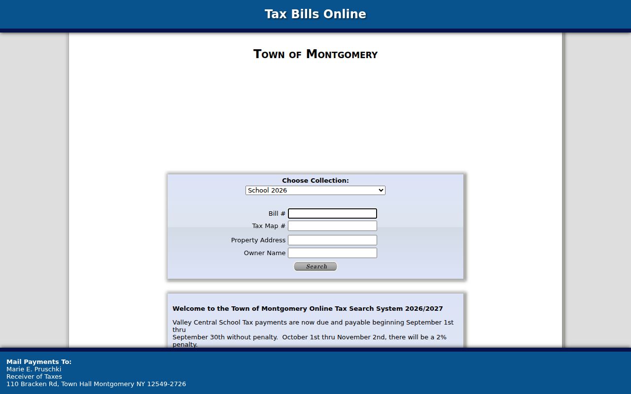
For a Town of Montgomery address search, compare the returned tax-map value with the GIS parcel and retain the assessment-roll date alongside any owner name.
Town of Montgomery Street Record Coverage
Different address records answer different questions. Assessment is a tax-roll snapshot, GIS is a mapping index, BAS is a bill interface, and a deed is a recorded transfer. The table keeps those limits visible before a Town of Montgomery address search is treated as evidence about a household.
| Address record | Town or county keeper | What it can show | Access route |
|---|---|---|---|
| Assessment roll and BAS | Town Assessor / BAS | Assessed owner, tax account, parcel context | Town roll and free public search |
| Parcel map | Orange County GIS | Boundary, parcel ID, map layers, Image Mate link | Free web viewer |
| Assessment images | Orange County Image Mate | Weekly assessment data, tax maps, photographs | Public access/login; live card fields unverified |
| Recorded deeds | Orange County Clerk | Recorded parties, instrument date, legal description | SearchIQS, Record Room, or historical routes |
| Building files | Town Building Department | Applicant, project, site, and dated work clues | Narrow request or FOIL; no public index found |
| Historical directories | Libraries and OCGS | Dated occupant or business clues where held | Collection-specific onsite or catalog access |
Image Mate uses weekly assessment data for Montgomery, but its live public card fields and historic coverage were not verified in the research. Record what the screen actually displays instead of assuming a standard list of fields.
Town of Montgomery Deed Chains by Address
Once the parcel and current assessed owner are known, the Orange County Clerk's online-records route points to SearchIQS for land-index access. The public login did not reveal a verified live field list or a current online cutoff. Its free Historical Only tier is not a current land-record tier; the research notes paid current and image tiers. When online access stops, use the County Record Room, County Clerk staff, FamilySearch historical books, or OCGS microfilm.
Search the owner as grantee to find an acquisition, then use the prior deed reference and legal description to work backward. A grantor is the seller and a grantee is the buyer. A mortgage, assignment, or satisfaction can add dates, but it is not a deed transfer and does not prove occupancy. Compare spouse or partner names, municipality, legal description, and recording date before accepting a same-name match.
The Orange County deed recording page identifies the county's requirements for recorded instruments. It is a source for how deeds are kept, not a substitute for an image or an index result.
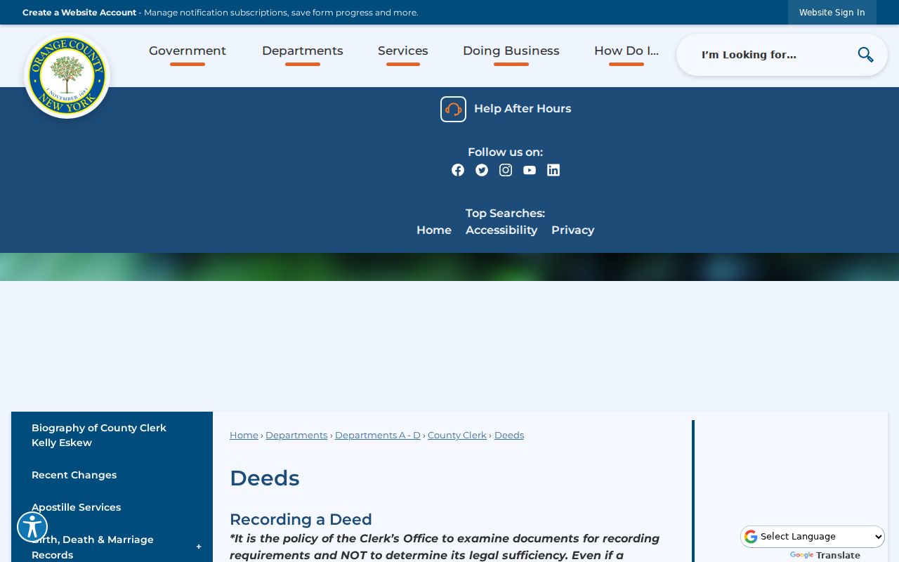
Historical County resources and FamilySearch cover deed books and grantor-grantee material from 1703 to 1900, with mortgage books from 1703 to 1869. For older or fragile material, the in-person trail remains part of the Town of Montgomery address workflow.
Note: A recorded owner, a tax-bill addressee, and a present occupant are separate descriptions that should never be merged without dated supporting evidence.
Town of Montgomery Street Jurisdiction Checks
A Montgomery postal address does not automatically identify the Town. The Town includes the incorporated villages of Montgomery, Walden, and Maybrook, and roads can cross a village boundary or ZIP area. Record the postal city, municipal label, and ZIP separately. County GIS layers are the practical public map source for the municipal label, while USPS is the final check for delivery formatting.
The local historical geography adds another reason to keep variants. The Village of Montgomery grew from Ward's Bridge and an early rectangular Clinton street plan. Bridge, Clinton, and Union were early streets in that plan. An old directory or deed may use a road, farm, bridge, or village label that needs comparison with a current parcel rather than automatic correction.
This corrects the assumption that one postal city settles every Town of Montgomery address result. The source's own place label and date should remain in the research log.
Town of Montgomery Address File Requests
Building, planning, zoning, and permit material can supply a date, project description, applicant, or owner reference for a particular site. No public Town permit or case index was located. The workable route is a focused request to the Building Department or a Town FOIL request that names the address, approximate date range, and record type. Broad requests for every file on a road are less likely to identify a usable record.
New York's Freedom of Information Law is Public Officers Law Article 6. Under §89(3)(a), an agency generally must grant, deny, or acknowledge a request within five business days, with a written extension process where appropriate. The Town Clerk at 110 Bracken Road routes Town records. A Town request cannot replace the County Clerk route for deeds, maps, county census books, or court papers.
Keep a request log with the agency, date range, parcel or tax-map reference, and whether the response supplied an index, a redacted copy, or no responsive record. That record trail is more reliable than reading a permit applicant as proof of a complete household.
Town of Montgomery Historical Street Entries
For a past address, a criss-cross or street-order directory can suggest a dated occupant or business. No complete Town-specific printed or reverse run was confirmed. The available shelf is regional: Vail's Orange County farmers and business directory for 1871/72, D.S. Lawrence & Co. for 1878/79, and incomplete OCGS city runs for Middletown, Port Jervis, and Newburgh. A regional hit needs its collection, year, municipality, and section recorded before it is linked to a Town address.
The historical work is collected in the Town of Montgomery city directories material. It explains how to read a volume and trace a household without treating a nearby-city run as Town-wide coverage. Pair a street entry with a deed, atlas, census, obituary, or newspaper notice when the distinction between owner and occupant matters.
Orange County Genealogical Society, Thrall Library, and the Goshen Local History Room are the onsite fallbacks when a scan is absent. The County Record Room also keeps offline historical material. A missing portal result is not proof that an older street record does not exist.
Town of Montgomery Records at Goshen
The Orange County Record Room is the main counter route for a deed image, map, historical census book, or fragile record that is not available online. Public computers are available there. Plain copies cost $0.65 per page with a $1.30 minimum. Certified copies cost $1.25 per page with a $5 minimum. Mail requests need a self-addressed stamped envelope. The county cautions that dates and digitization vary, so ask what is available before treating an online gap as final.
For an efficient request, bring the street address plus the parcel ID, tax-map number, document number or book/page reference if one has been found. The County Clerk at 255 Main Street in Goshen has separate contacts for general clerk service, recording documents, court papers, and the Record Room. That split matters because an address clue can lead to several different record groups.
Note: Public terminals and copy services can reveal material not exposed by a web interface, but some fragile records may still have access limits.
Town of Montgomery Street Directory Limits
A Town of Montgomery street directory cannot reliably show every non-owner household member, guest, or unregistered voter. DMV addresses, utility accounts, delivery records, and protected-voter or Address Confidentiality Program addresses are not a general street resource. The NY Voter Lookup requires Orange County, last name, first name, date of birth, and ZIP. It is an individual election-service form, not a street roster.
New York Election Law restricts voter-registration information to election purposes, and the state's confidential-registration route protects eligible voters. DPPA rules also restrict DMV information. Public records may contain redactions, and a parcel, ZIP, or substitute address must never be used to infer a protected location.
Lawful use. Use Town of Montgomery address records for a legitimate personal research purpose and respect every confidentiality limit. Do not use a record trail to stalk, harass, intimidate, or harm anyone.