
Town of Montgomery Neighbors by Block
A Town of Montgomery neighbor lookup works best as a short, documented review of the block around a target parcel. The Orange County GIS viewer shows parcel geometry, road and address context, map layers, and linked parcel tools. Assessment records can add owner or tax-account context. The County Clerk’s deed route supplies the legal-description check. Historical sources describe earlier people or organizations along a street, while municipal civic pages identify public governance material. Each source has a narrower role than a general neighbor roster.
| Block source | What it shows about a block | Access |
|---|---|---|
| Orange County GIS parcel boundaries | Nearby or touching parcel candidates, parcel IDs, municipal layers, roads, and address points | Free viewer with buffer and export tools |
| Image Mate | Linked assessment and property-image route for a selected parcel | County public access or login; live card fields were not captured |
| Assessment roll and BAS | Assessed owner or tax-account context and bill address | Town roll and free public tax search |
| County Clerk deed route | Recorded transfers, legal descriptions, and some easement references | SearchIQS, Record Room, or historical-book routes |
| New York voter lookup | An individual registration or polling hypothesis | Individual form, not block browsing |
| Directories and newspapers | Historical occupants, organizations, notices, and local names | Libraries, OCGS, Goshen, Walden, and HRVH sources |
| Civic and preservation pages | Public meetings, local-register material, and historical context | Town public pages and Historian appointment route |
An assessment or BAS result identifies an assessed owner or tax account. It does not show every person at the property. Likewise, map proximity creates a set of parcels to examine, not a conclusion that two parcels have a shared boundary or common ownership.
Town of Montgomery Neighbor Parcel Search
Begin with the target in the Orange County GIS viewer. Parcel Search accepts owner name, address, or parcel ID, and partial strings can work. Municipality or map-area choices narrow the results. The Find Address tool accepts address, city, state, and ZIP, with autocomplete to narrow likely matches. Record the parcel ID, road frontage, municipal label, and map scale before moving to surrounding parcels. This makes the block search repeatable if a road crosses a village or ZIP boundary.
The GIS Parcel Search help describes those parcel and municipality choices. Its partial-match behavior is useful when a road name or historical address is incomplete, but it is still necessary to confirm the exact map result rather than treating a partial search as a final match.
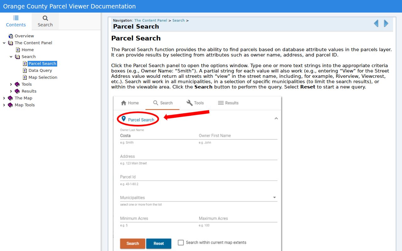
The parcel-search controls give a Town of Montgomery block inquiry a defined starting point before any nearby owner-of-record results are reviewed.
Note: Keep postal city, municipal boundary, and parcel ID as separate facts because Montgomery, Walden, and Maybrook labels can overlap.
Map Town of Montgomery Neighbor Parcels
Once the target parcel is on the map, browse the adjacent polygons or use the GIS Buffer tool. Buffer requires a target, distance, and units, then selects nearby features. Open Parcel Details for each candidate and use the result table’s CSV export to preserve the set that was examined. The linked Image Mate route can provide another assessment-side check. This workflow identifies a nearby parcel set without asserting that the map alone settles a legal boundary.
- Locate the address and capture its parcel ID, road frontage, municipal label, and map scale.
- Map-browse the surrounding polygons, or use Buffer with a chosen distance and units when the nearby set needs a consistent rule.
- Open Parcel Details for each candidate, then export the selected query table to CSV for a dated research note.
- Follow the Image Mate link where available and compare the tax-map, owner-of-record, mailing, and situs fields without treating a mailing address as occupancy evidence.
- Confirm the relevant relationship through a County Clerk deed and legal description. For a whole named street, use the fuller Town of Montgomery street directory workflow.
The GIS result-tools help documents the buffer, zoom, export, and Image Mate-link functions. Those tools create an auditable candidate list, but deeds and surveys control the legal question of a boundary.
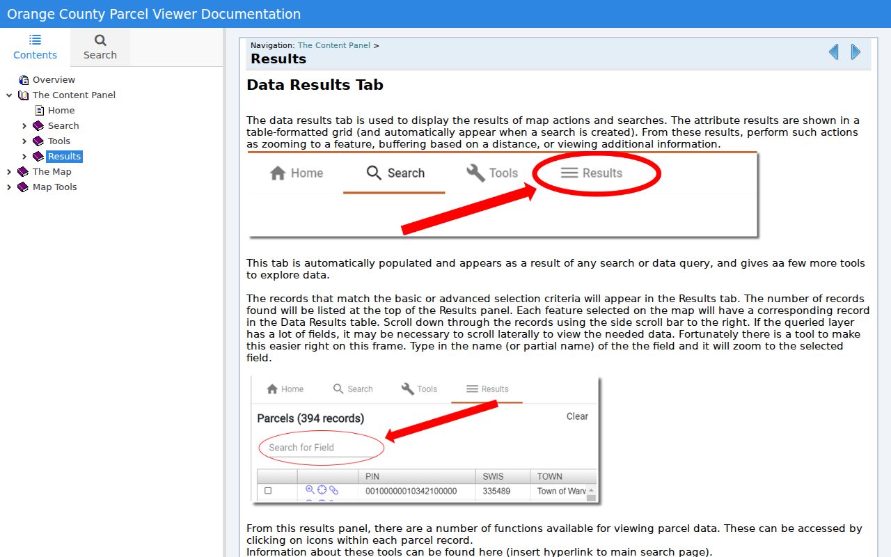
Using the buffer and export tools keeps the block review tied to a recorded map query rather than memory or an untested map impression.
Town of Montgomery Neighbor Record Checks
Use the map result as a lead, then check ownership through the Orange County SearchIQS land-index route or the County Clerk Record Room. A recorded deed can identify grantor, grantee, recording date, document number or book and page, legal description, and earlier references when the relevant access tier or image is available. Compare the legal description, parcel clues, municipality, and date. Do not treat an owner-name match alone as enough, especially when names repeat.
The Town’s BAS tax search accepts property address, owner, tax map, and bill number. It is useful for returning to the assessment context after the GIS review. Payment information and a tax-bill mailing address are not evidence of who lives at the parcel. A deed can also mention easements, rights-of-way, maps, or subdivision instruments that explain a driveway or frontage relationship between nearby parcels.
- Adjacent parcel
- A parcel that appears touching or close to the target on a map. Legal descriptions or a survey are needed to confirm the boundary relationship.
- Owner of record
- A person or entity named in assessment or recorded-transfer material. The label does not assert who occupies the parcel.
- Legal description
- The title description in a recorded instrument, using lots, acreage, roads, boundaries, or related references. It is the key check after GIS proximity.
Town of Montgomery Voter Lookup Limits
New York’s voter lookup is an individual service, not a Town of Montgomery neighbor roster. The official form requires Orange County, last name, first name, date of birth, and ZIP. It is intended for a registered voter’s registration, polling-place, or related election response. The research did not verify a public result screen that supplies a block list, address field, party history, or household list, and the state’s voter-data request rules require an elections purpose.
| County | Orange is required for the local query. |
|---|---|
| Name and date of birth | Last name, first name, and date of birth are required matching inputs. |
| ZIP | A five-digit ZIP is required, but it is not proof of a Town or village jurisdiction. |
| Lawful purpose | Election-file access follows New York election rules and stated elections-purpose restrictions. |
Use the New York voter lookup only for the narrow individual question the system serves. Confidential voter registration under Election Law §5-508 is a safety safeguard, not a search feature. It must never be used as a reason to infer a protected address from a parcel or ZIP.
Town of Montgomery Neighbor Source Comparison
Official records and commercial neighbor-finder categories serve different purposes. The official route identifies the custodian, date, field, and limitation of a record. Commercial services may combine records from different dates and may require their own correction or privacy-request steps. Neither category turns a block into a reliable list of every household member. For a Town of Montgomery neighbor question, the source and limitation are more useful than a long unverified name list.
| Source type | Useful for | Critical limit |
|---|---|---|
| Official GIS, assessment, and deed sources | Parcel, assessed-owner, and recorded-transfer evidence with a named custodian | They do not establish every occupant or every legal boundary from a map alone |
| Commercial people-finder category | General lead generation or a privacy-request route for a specific profile | Coverage and dates can be incomplete or stale; results need independent confirmation |
When an official record looks mistaken or outdated, use the assessor, County Clerk, court clerk, Board of Elections, or other original custodian for a correction route.
Town of Montgomery Neighbor Civic Context
Town of Montgomery civic sources can add public context to a block question without becoming a private membership list. The Police Community Advisory Board publishes its mission, public members, agendas, and minutes around trust, communication, transparency, accountability, and policy or program advice. The Historic Preservation Commission identifies eligible historic properties and maintains local-register and Certificate of Appropriateness material. The Historian can help with a focused address, road, farm, map, or date-range question.
Police Community Advisory Board
Public agendas and minutes provide civic-governance context, not a neighborhood membership list.
Historic Preservation Commission
Local-register and Certificate of Appropriateness material can support a historic-property inquiry.
Town Historian
Mary Ellen Matise is available by appointment for a focused local-history request.
The Town Police Community Advisory Board is the documented civic source for its own meetings and materials.
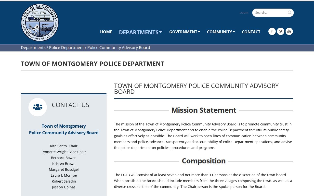
The board’s public information helps explain a Town of Montgomery civic process; it does not identify the people who live around a particular address.
No official Town-wide HOA, block-watch, congregation, or neighborhood-association member directory was located in the research. Use published organization contacts or meeting materials where they exist, and do not infer membership from an address.
Town of Montgomery Neighbor Privacy
Important block information remains private. Public property systems do not reliably identify all occupants or household members. DMV information, utility accounts, delivery records, protected voter locations, and Address Confidentiality Program physical addresses are not general neighbor-search material. New York FOIL permits privacy redactions where disclosure would be an unwarranted invasion, and New York’s DPPA restrictions also limit DMV information to permitted uses.
Lawful use. Use Town of Montgomery neighbor sources for civic transparency, property curiosity, family-history questions, and personal safety awareness. Do not use them to monitor, harass, intimidate, or harm anyone.
For a protected-address concern, use the New York Address Confidentiality Program or the confidential voter-registration route, rather than trying to reverse a substitute address or a public map clue. Correct a tax, deed, court, or election record with its original custodian.